
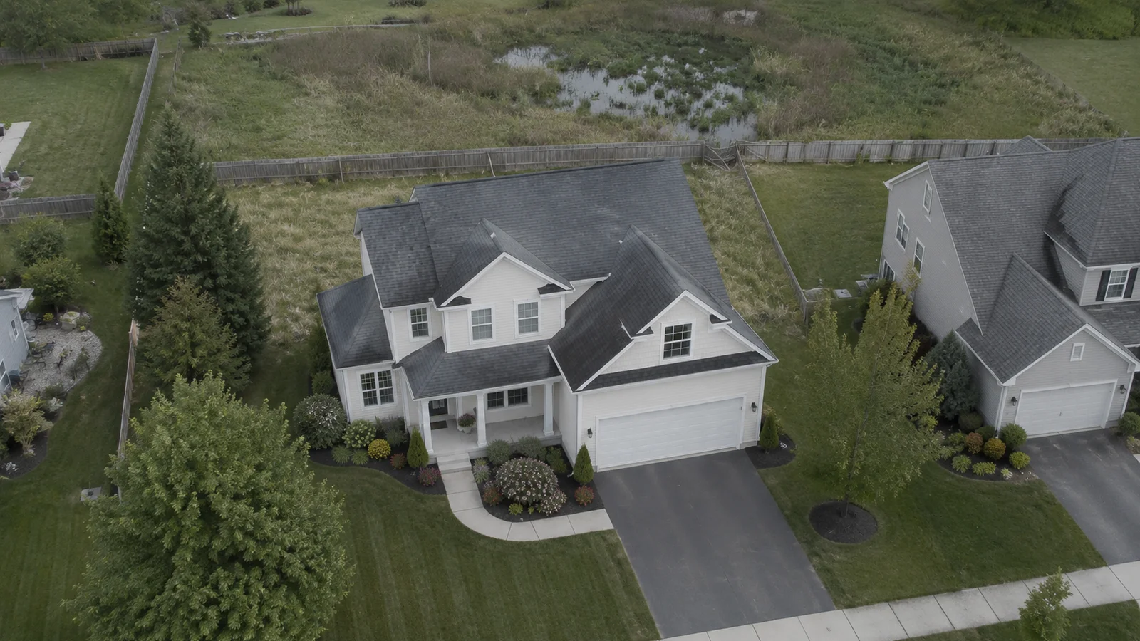
Real estate listing photo of a suburban home
LISTING PHOTO
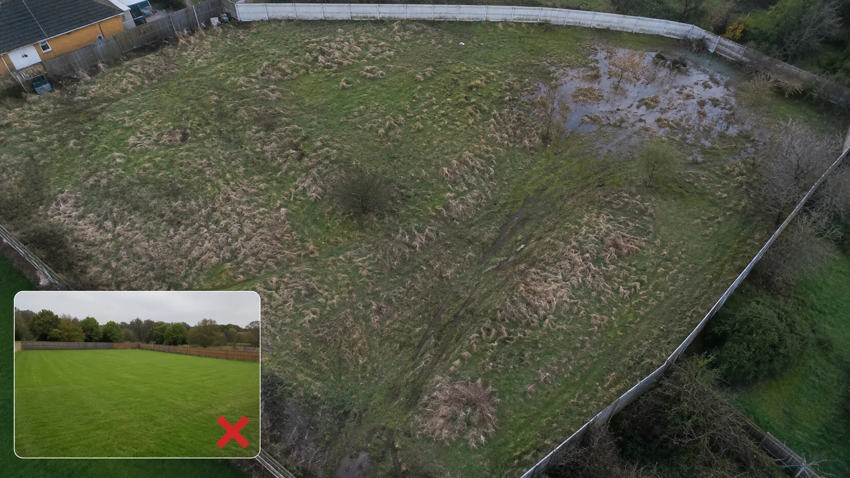
TrippleAir verified drone aerial of the same property
GPS: 6.5244° N, 3.3792° E
ALT: 42.1M  ·  HDG: 274°
2024-08-22  ·  09:14:33 UTC
▣ LOCKED  ·  UNEDITED FOOTAGE
OPERATOR SCAN ✓

Drag the slider above to see the difference

What they show you.
vs. What's actually there.

Independent aerial and ground inspection for land and property. Unedited evidence gathered by someone with no stake in the sale.
⚡ Book as guest — no account Get Verified Evidence  → Sign In
The Gap

What listing photos hide — and what an independent scan reveals

Aerial evidence of a property misrepresented in its listing
FINDING 01

"Dry land" — the elevation map shows this plot sits below the surrounding drainage line. It floods seasonally.

FINDING 02

"Prime location" — nearest paved road is 38 minutes away. The listing photo was shot from inside the plot, cropping out the access track.

FINDING 03

"Recently cleared" — drone footage shows dense regrowth consistent with land that floods annually and re-establishes vegetation each dry season.

FINDING 04

"Safe investment" — GPS boundary logs show the plot boundary overlaps a neighbouring claim. No title survey was provided in the listing.

FINDING 01 · DRAINAGE

"Dry land."  Actually: a seasonal floodplain.

A single photograph taken on one dry week cannot show you that the same plot sits under 60cm of water four months of the year. An elevation scan and multi-season drone pass does.

FINDING 02 · ACCESS

"Prime location."  Actually: 38 minutes from a paved road.

Listing photos are shot from inside the plot. They can't show what's missing. A ground-level mobile operator drives the access route and records it. That footage becomes part of your report.

FINDING 03 · VEGETATION

"Recently cleared."  Actually: annual flood regrowth.

Dense, low regrowth is a reliable indicator of plots that flood and re-vegetate on a cycle. Without a comparative aerial pass, a buyer has no way to distinguish cleared land from flood-prone land.

FINDING 04 · BOUNDARY

"Safe investment."  Actually: boundary overlap on record.

GPS-tagged boundary logs included in every TrippleAir report let you compare against survey coordinates before you commit. An ambiguous boundary is caught before the contract is signed.

Global Telemetry Engine

Independent operators. Everywhere you need them.

Operator Network

Indicative operator distribution · Not a live feed

Certified Operators
0
Verified and active on the platform
Platform total · Updated periodically
Flight logs this week
340
Unedited, submitted for AI validation
AI Validation Pass Rate
98.2%
Evidence met coverage & quality bar
Launch Marketplace App  →

Free to create an account. Pay only when you book an inspection.